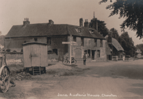
THESE vintage pictures taken on the River Wey Navigation in the area around Triggs Lock and Send reveal there hasn’t been a great deal of change for over 100 years.
Triggs Lock, not far from Sutton Green, remains a delightful spot with a lovely little lock-keeper’s cottage. The picture postcard view dates from the early 1900s.
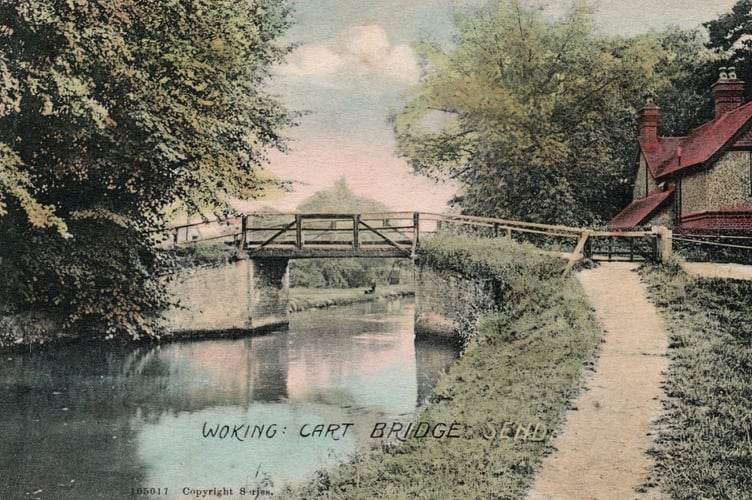
The postcard view of Cart Bridge (postmarked on the reverse as 1905) looks upstream. The main difference being that today there is a brick and concrete bridge that carries the A247 over the waterway.
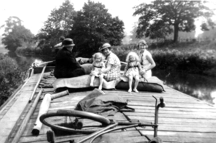
The photo taken on one of the old horse-drawn Wey barges, with a family taking a ride, appears to date to about the 1920s or 30s. The barge’s skipper can just be seen at the tiller. Unfortunately the exact location is not known, but believed to be downstream from Guildford’s Stoke Lock, perhaps near Sutton Place.
The River Wey Navigation was one of the first waterways to be canalised in Britain. The man we can credit with the idea is Sir Richard Weston of Sutton Place.
He was born in 1591 and educated in Flanders. He was impressed with the pound locks he saw in the Low Countries and how rivers there were being made navigable.
He was also interested in ways to improve agriculture, and in 1618 he dug a channel three miles long, with a pound lock, to control water around his estate. He called it the Flowing River.
By deliberately flooding his fields in winter, the soil underneath was less likely to freeze and therefore when drained was quicker to warm up ready for planting in springtime.
His next idea was the make the natural River Wey navigable throughout, from Weybridge to Guildford, a distance of about 15 miles.
His plan was delayed by the English Civil War, but in 1651 an Act of Parliament was granted to ‘Guildford Corporation and others to make the River Wey navigable at their own expense’.
James Pitson, a former major in Oliver Cromwell’s army, was appointed to construct the waterway and to raise the money for it.
Nine miles of canal were cut, with 12 locks and 20 bridges. It cost £16,000. About 200 men were employed on the job and it took them just two years, opening for trade in 1653.
Slowly the navigation prospered and barge traffic increased up and down. It included agricultural produce, flour, timber, paper, beer and even gold bullion and gunpowder!
With an extension from Guildford to Godalming opened in 1764, the waterway continued to carry cargo up until the 1960s. Latterly it was mostly grain, barged up the Thames from the London docks, through Thames Lock at Weybridge to Coxes Mill at Addlestone.
The waterway was owned and run by several generations of the Stevens family. In 1964, Harry Stevens offered it to the National Trust.
Today, the National Trust manages the navigations as a leisure waterway. There are eight lengthsmen who look after the navigation (two of them women) and between them they have clocked up 125 years of service for the National Trust. A timely number as January 2020 is the 125th anniversary of the National Trust itself.
The navigation is great to explore either on foot or by boat. Its visitor centre at Dapdune Wharf in Guildford is well worth a visit to learn more about its history.
If you have some memories or old pictures relating to the Woking area, call me, David Rose, on 01483 838960, or drop a line to the News & Mail.
David Rose is a local historian and writer who specialises in what he calls “the history within living memory” of people, places and events in the west Surrey area covering towns such as Woking and Guildford. He collects old photos and memorabilia relating to the area and the subject, and regularly gives illustrated local history talks to groups and societies. For enquiries and bookings please phone or email him at: [email protected]

